
“He-ee-ey d-d-d-ooooo y-oo-uu fee-ee-eel a-nnn earth-qua-aa-a-ak-e?”
Earthquakes are pretty common in Southern California. In fact, there are around 12,000 earthquakes in the area each and every year!
Though the majority of the earthquakes that happen in the region are pretty small and can’t be felt up here on the surface, at least 15 of those earthquakes per year are big enough to measure above a 4.0 magnitude and can result in slight tremors.
There’s a lot of earthquake-speak when a big enough earthquake occurs, especially if an especially large one from somewhere else in the world hits the international news. There are a lot of numbers, a bunch of seismological terms and plenty of talk about aftershocks, epicenters and whatnot that help paint a picture of what’s happening deep underground.
Here’s a little bit about earthquakes, what causes them, what the terms mean and, of course, an overview of the earthquake scene right here in Southern California!
All about the earthquakes around Los Angeles
What causes earthquakes?
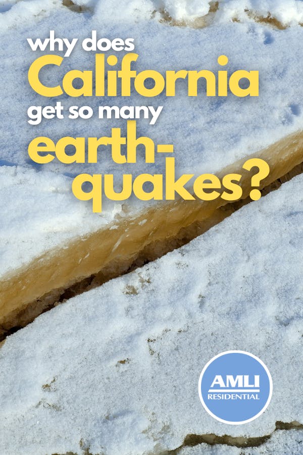
Earthquakes come in all shapes and sizes, but all of them occur when two or more tectonic plates slip against each other, releasing stored-up pressure in the form of quakes.
The Earth’s crust is made up of a series of tectonic plates that are constantly moving toward and away from each other. Sometimes, one tectonic plate will slide under another plate, while its other end moves away from its neighbor and leaves openings between the two. Plates may collide with each other head-on, or they may travel beside each other in opposite directions. Anywhere where that kind of movement occurs is known as a fault.
The movements of these tectonic plates is what creates mountain ranges, volcanic eruptions, deep fissures in the depths of the ocean and, of course earthquakes!
For example, say two neighboring tectonic plates have been sliding in opposite directions for a few million years. As those two plates slowly grind against each other, they create an insane amount of friction and pieces of the plates may catch onto each other. Pressure builds up in that compression zone when, eventually, the stress is too much and it gets released in the form of earthquakes. This process of building and releasing pressure happens at fault lines all over the world, and the effects from these movements creates mountains, valleys and other geological formations within hundreds of miles of those lines.
A few earthquake terms that are good to know
Understanding the details of specific earthquake zones requires a little bit of context, especially when we start talking numbers. Plus, it helps paint a better picture of what’s happening beneath the surface (hah!).
Seismology: basically, the study of earthquakes and their effects. Anything with “seism-” in it refers to something involved with that area of study, like seismologists, seismic waves, seismicity, etc.
Epicenter: this is a point on the surface of the earth directly above where the earthquake originated and is focused, no matter how deep underground it started.
Seismic waves: earthquakes release pressure in waves, generating vibrations in the rocks and water around it. These waves are measured and used to determine the frequency, amplitude and magnitude of the earthquake.
Magnitude: this refers to the amount of energy generated and released by the earthquake. It’s measured using a Richter scale, which uses the height of the highest wave measured in a seismic wave. Each level (measured in 9 levels) represents 10 times the amount of shaking and 31 times the amount of energy than the previous level. The magnitude of an earthquake is measured by the waves at the epicenter.
Foreshocks and aftershocks: sometimes, small earthquakes occur in clusters preceding and following the stress release of one much larger earthquake known as the mainshock. The smaller earthquakes are called foreshocks, while the ones following the mainshock are called aftershocks.
Earthquakes in Southern California
The Pacific Ocean is, for the most part, one large tectonic plate known as the Pacific plate.
The edge of the Pacific Plate runs from the tip of South America along the western coast of North America, across along the southern edge of Alaska and down the east coast of Asia down to New Zealand — a path known as the Ring of Fire for all the volcanic activity along the faults.
California lies directly on top of the San Andreas Fault, which marks a large section of the seam between the Pacific and the North American tectonic plates along the Ring of Fire. The Pacific Plate is moving slowly northwest while the North American Plate is moving southeast, with the two plates scraping and grinding against each other as they move.
Southern California lies on a part of the seam called the “Big Bend” in the San Andreas Fault, which is characterized by a bend in the seam that causes the two neighboring plates to compress against each other. In fact, there’s so much pressure generated by that small bend that the plates have smushed together (that’s a scientific term, right?) and formed the range of mountains surrounding Los Angeles and our Southern California apartments.
The Big Bend and the resulting pressure along the San Andreas Fault has resulted in hundreds of smaller fault lines around the region. So many, in fact, that the San Andreas Fault is generally referred-to as the San Andreas Fault Zone, which encompasses over 300 additional faults caused by the Bend.
That’s why Southern California gets more earthquakes than most other regions along the California coast, and why you’re more likely to feel tremors there than anywhere else in the continental United States.
It’s also one of the best places to get an up-close look at a fault line and to see exactly how this part of Earth’s anatomy works! Wallace Creek in San Luis Obispo County offers some of the best views of the fault line anywhere, with a visible seam and signs of offset from where the land has moved. You can also see the fault and the effects of its movements at Pinnacles National Park, at Carrizo Plain National Monument and at these other California locations.
Southern California is the best in a lot of things. Hollywood, citrus production, wine-making and, of course, earthquakes! These earthquakes have been a part of life here in sunny SoCal for millions of years and will probably continue to do so for the next few million years, too. Might as well get used to them, huh?
Piii-iii–nnn iiii-ttt-t-ttt-t!
Featured photo courtesy Pixabay/jplenio

Colleen Ford is a South African who now lives on Oahu in Hawai'i. She loves to travel, camp, spearfish and hike. She's also part of a super cool canoe club and is pretty decent at it. Colleen enjoys Star Wars and also not being cold ever.