
Driving in the Southeast is always a surprise. The highways and main roads are lined with thousands of miles’ worth of pine trees, and the only indications of roadside attractions we have are the signs and billboards directing us to the next place of interest.
I lived in the South for a decade, and I still have absolutely no idea what’s behind the rows of pine trees lining the highways and interstates. It was only recently that I found that I lived 30 minutes from an absolutely gorgeous little lake. Ten years driving past it every day, and I never even knew it was there.
But that’s the thing, right? Georgia is full of these little gems that hide just behind those endless rows of pine, and we may never know they’re there until we take a wrong exit, hunt for a gas station or a turn off for a roadside snack.
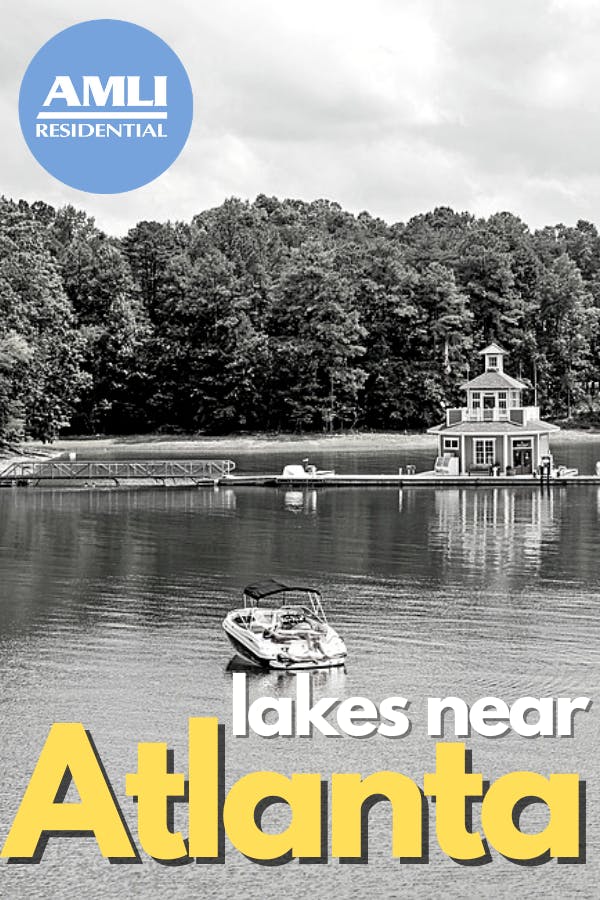
If you look at a map of Atlanta, you’ll see that the area around the city is scattered with little lakes just like this. Some of them are no more than large ponds, sure, but there are plenty of decently sized lakes all over the place. And there are enough of them that all of our residents in our luxury Atlanta apartments can enjoy them any time!
Funnily enough, most of Atlanta’s lakes are not there naturally. In fact, they are the result of a vigorous infrastructure focus back in the 1950s. Many of the smaller lakes and ponds are natural, sure, but the only large natural lakes are a few in the southern section of the state. All of the large lakes in northern Georgia are man-made.
There are a few different kinds of lakes, both man-made and natural, that we’ll need to distinguish from each other to really understand why Atlanta’s lakes are the way they are. Each is formed in different ways and has different characteristics, and all of them can tell us a little about the very history of the land they inhabit.
Types of lakes
Reservoirs
Reservoirs are caused by a river or stream becoming dammed, either by animals, humans or natural occurrences. Beavers are the most common animals to cause damming, and have been doing it long before humans arrived with concrete and steel. Damming can also occur when debris clogs up a narrow portion of a river, which, if enough time goes by, can create massive lakes behind these natural clogs.
Because reservoirs are formed along the paths of rivers, streams or creeks, the shape of the water will contour to the shape of the land around it. Where natural lakes are generally more rounded, reservoirs have long tendrils that fill in the drainages that surround the river.
Since a reservoir fills backward from the blockage (i.e., the dam wall, the beaver dam or the debris clog), the deepest part of the reservoir will usually be close to the downstream portion of the water. Natural lakes are usually deepest right in the center.
These are some easy ways to tell if a lake is, in fact, a man-made reservoir. That, and the likely presence of a massive concrete wall on the downstream end.
Lakes
Lakes are one hundred percent natural, although they can form in a few different ways. Some form from tectonic movements, some form from sinkholes and some are a result of ancient glacial activity through the region. Because Georgia doesn’t display much evidence for significant glacial or tectonic activity in more recent history, there isn’t much in the natural landscape to support natural lakes. Rivers and streams, yes. Lakes, no.
Playas
Although technically these could be considered naturally occurring lakes, playas are formed from irrigation or runoff and aren’t permanent enough to be considered lakes. When heavy rainfall or irrigation pools in the land around it, shallow bodies of water that contour to the shape of the land can form. These small “lakes” can be permanent or seasonal, depending on the source.
Oxbow lake
Many of the smaller natural lakes in Georgia are oxbow lakes, which form from rivers that change course over time. Wide bends in rivers can become their own free-standing bodies of water when the river changes course, leaving a narrow, U-shaped lake behind.
Since Georgia’s landscape is perfect for rivers and streams, it makes sense that little oxbow lakes formed alongside them over the course of the landscape’s history.
Lakes around Atlanta
Now that you know the difference between the different types of lakes, you can tell that two of the largest lakes around Atlanta are, in fact, manmade.
Lake Lanier was created in 1956 when the U.S. Army Corps of Engineers dammed up the Chattahoochee River in order to create a better flood control system for the city of Atlanta. Not only is the lake now a source of drinking water for the city, but the 38,000-acre lake is a popular destination for campers, swimmers, hikers and more!
Lake Allatoona serves as both a source of drinking water and hydroelectric power to nearby Cartersville, as well as a wildlife sanctuary and water quality monitor. In fact, the 1941 construction of Allatoona dam was the first of its kind for the U.S. Army Corps of Engineers, as it was one of the first dams to be constructed under the Flood Control Acts of 1941 and 1944.
These lakes may be man-made, but that doesn’t diminish their significance to flood control, wildlife preservation and recreation in the area even slightly. Millions of people enjoy swimming and boating on these lakes every year, and there’s no reason to stop!
Enjoy!
Pin it!
Featured photo courtesy Pixabay/ChanhNguyen

Colleen Ford is a South African who now lives on Oahu in Hawai'i. She loves to travel, camp, spearfish and hike. She's also part of a super cool canoe club and is pretty decent at it. Colleen enjoys Star Wars and also not being cold ever.